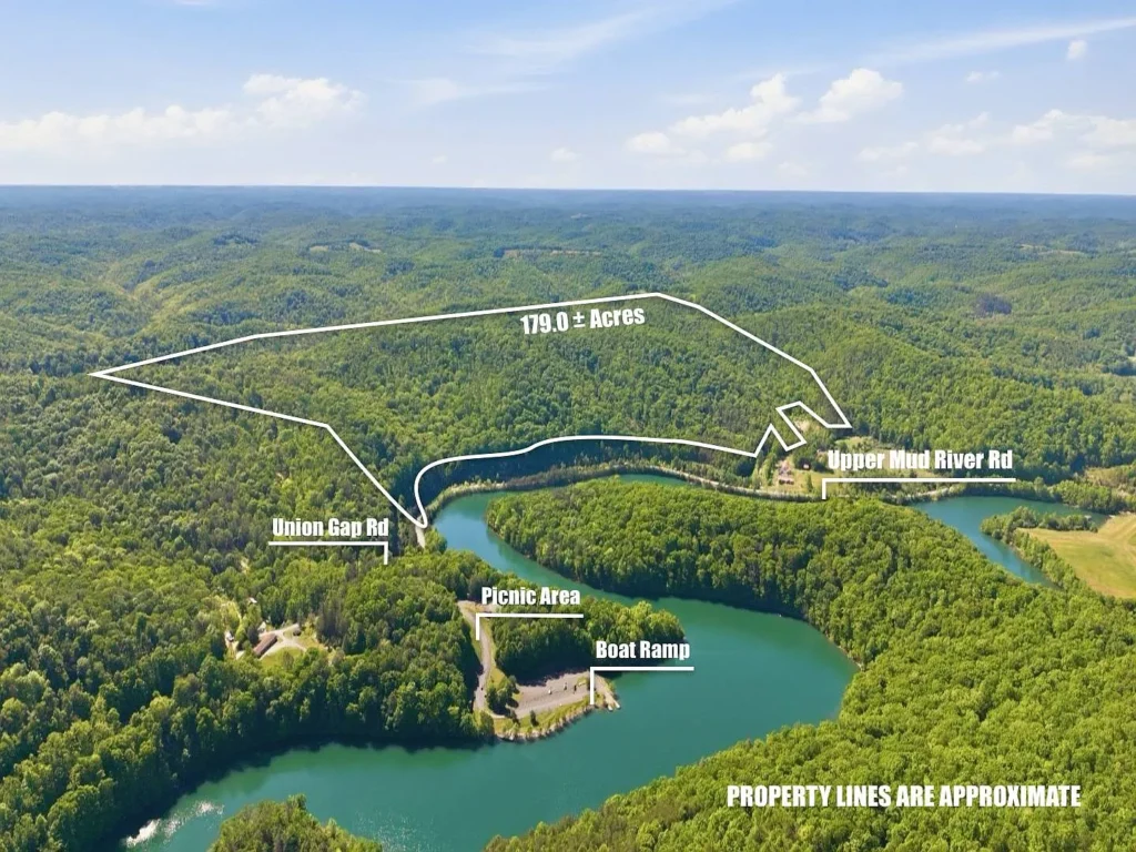
Acquiring a continuous 179-acre mountain land package in West Virginia for under $250,000 is an increasingly rare occurrence in the Mid-Atlantic real estate market. Listed at $220,000, the property located at 0 Lovejoy Cemetery Rd, Branchland, WV 25506 offers an entry-level price point for land banking investors, avid hunters, timberland managers, and homesteaders in Lincoln County.
Breaking down to a microscopic $1,229 per acre, this property features 179 acres of select-cut timberland, established interior logging roads, multiple cleared building and food plot sites, man-made wildlife water holes, and road-front electric and natural gas utilities.
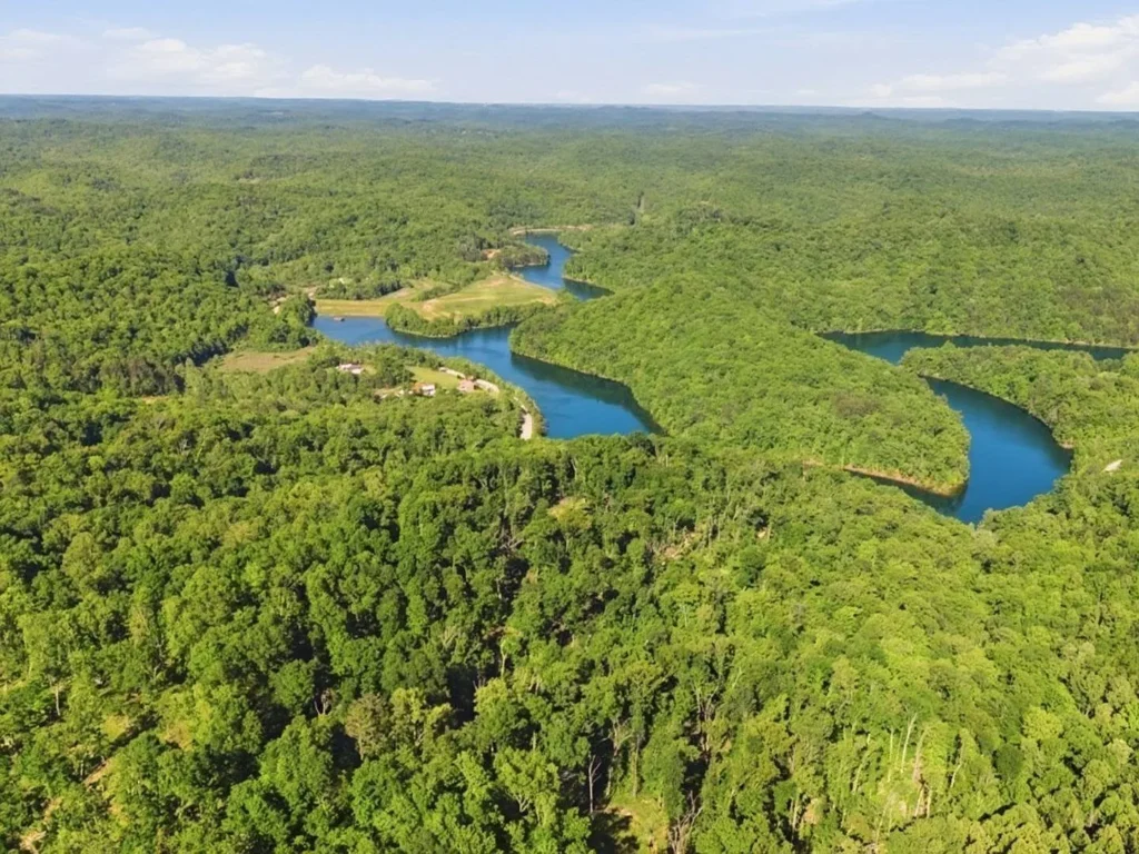
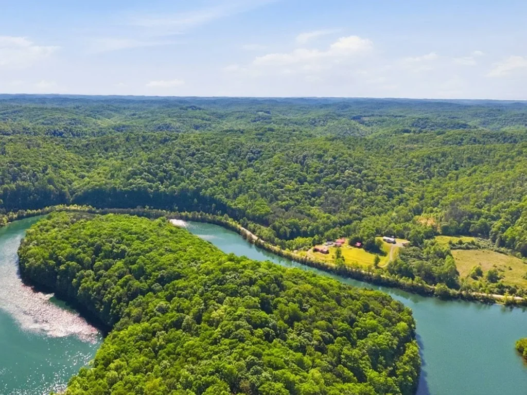
Crucially, the property directly borders the 1,425-acre Upper Mud River Wildlife Management Area (WMA) and the 306-acre Mud River Lake, effectively expanding the owner’s accessible outdoor playground to over 1,600 contiguous acres of recreation.
Below is an expert breakdown covering property specifications, structural pros and cons, valuation mechanics, and a final purchase verdict.
Property Specifications at a Glance
| Metric / Feature | Property Specifications | Strategic Land Takeaway |
|---|---|---|
| Listing Price | $220,000 | Exceptional sub-$250k entry for double-digit/hundred-plus acreage |
| Price Per Acre | $1,229 / Acre | Priced roughly 45% below Lincoln County rural acreage averages |
| Location | 0 Lovejoy Cemetery Rd, Branchland, WV 25506 | Tucked in southern Lincoln County; 12 miles south of Hamlin |
| Total Lot Footprint | 179.00 Deeded Acres | Massive spatial scale with purple-paint boundary marking |
| Bordering Public Asset | Upper Mud River WMA (1,425 Acres) | Instant access to 1,425+ acres of public land & 306-acre lake |
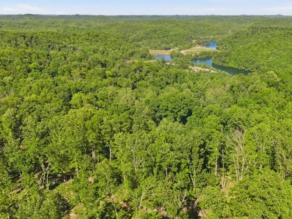
| Timber & Canopy Status | Select-Cut Hardwood Canopy | Oak, hickory, maple & poplar; opened woods create thick wildlife bedding |
| Topography Range | 740 Feet to 1,120 Feet Elevation | Rolling ridges, hollows, flat hilltop knobs & cleared house seats |
| Utility Availability | Grid Electric & Natural Gas at Road | Lowers initial site development expenses for residential building |
| Annual Tax Overhead | ~$1,100 / Year (~$92/Month) | Microscopic holding costs for long-term land preservation |
| Mineral Rights Status | Seller-Owned Rights Transfer | All oil, gas, and mineral rights owned by seller convey at closing |
Key Value Drivers: Why This 179-Acre Tract Stands Out
| Value Investment Factor | Specific Property Advantage | Strategic Investor Impact |
|---|---|---|
| Spatial Land Footprint | 179 Deeded Acres ($1,229/Acre baseline) | Massive land bank priced ~45% below county averages |
| Public Land Multiplier | Borders 1,425-Acre Upper Mud River WMA | Expands accessible hunting territory to 1,600+ acres |
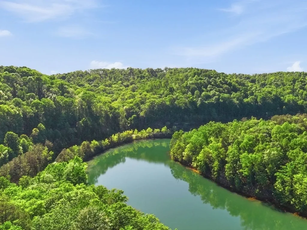
| Water Access & Boating | Directly Adjacent to 306-Acre Mud River Lake | Instant access to public boat ramps, fishing & beach |
| Infrastructure Prep | Internal Trail Network from Logging Roads | Established UTV/ATV access routes across all ridges |
| Utility Readiness | Electric & Natural Gas Available at Road | Eliminates thousands in off-grid power setup expenses |
| Sub-Surface Assets | Transferable Seller-Owned Mineral Rights | Full sub-surface asset control included with deed transfer |
1. The Mud River WMA Expansion Multiplier
The single greatest asset of this land package is its location directly adjacent to the Upper Mud River Wildlife Management Area (WMA).
- 1,425 Acres of Public Hunting & Hiking: Buying 179 private acres that touch a 1,425-acre state management zone gives you the functional hunting experience of over 1,600 continuous acres.
- 306-Acre Mud River Lake Access: Located right next door, Mud River Lake features a 10-horsepower limit motor regulation, two public boat ramps, a swimming beach, restrooms, and established fisheries stocked with largemouth bass, musky, crappie, bluegill, and channel catfish.
2. High-Density Wildlife Habitat & Select-Cut Forest Mechanics
A common misconception among land buyers is that recent timber harvesting destroys land value. In reality, a strategic select-cut creates prime wildlife conditions:
- Thick Bedding Cover: The removal of select canopy trees allows sunlight to penetrate the forest floor, triggering secondary growth of native browse, thickets, and briars. This creates dense thermal cover where trophy whitetail bucks, wild turkey, and black bear bed down.
- Established Trail Infrastructure: The logging skid trails cut by timber operators serve as a pre-built network of ATV/UTV trails, walking paths, and access corridors across the 179 acres.
- Ridge Top Water Holes: The property features multiple man-made water holes along the upper ridge tops, keeping wildlife on your side of the boundary line during dry autumn hunting months.
3. Utility-Ready Building Knobs
Developing deep-woods mountain property frequently requires running electric utility lines over long distances at steep costs. This parcel features grid electric and natural gas lines running along the main road frontage, providing clear sites to install a permanent home, hunting cabin, or RV pad.
Critical Risk Factors & Disadvantages to Consider
A disciplined real estate analysis requires evaluating the physical liabilities, access conditions, and needed site prep before placing an offer.
1. Topography Variance (740′ to 1,120′ Elevation)
- Mountain Terrain Realities: With an elevation change of nearly 380 feet across the boundary, a significant portion of the 179 acres consists of steep mountain hollows and sidehills. While steep ground provides wildlife cover and privacy, buildable flat ground is concentrated along ridge tops and road frontage pockets.
2. Lack of Existing Well Water and Septic Infrastructure
- Site Preparation Capital Required: Although grid electric and natural gas are available at the road, there is no pre-existing drilled well or septic system on site. Buyers intending to build a residential cabin should budget $12,000 to $22,000 for a drilled well and engineered septic tank installation.
3. Federal / State Boundary Management
- Boundary Maintenance: Because the parcel borders public land, owners must maintain clear boundary lines (currently marked with purple paint and locked gate access off Hill Road) to prevent public land hunters from inadvertently trespassing onto private grounds during peak hunting seasons.
Comprehensive Financial & Valuation Analysis
At $220,000, analyzing this property requires looking at the raw land cost, regional land baselines, and estimated monthly carrying costs.
Regional Land Price Comparison
| Regional Market / Tract Type | Average Price Per Acre | Cost for 179 Acres (Equivalent) |
|---|---|---|
| 0 Lovejoy Cemetery Rd (Subject Property) | $1,229 / Acre | $220,000 (Actual List Price) |
| Lincoln County Unimproved Land Average | $1,800 – $2,500 / Acre | $322,200 – $447,500 |
| Cabell / Wayne County Boundary Land | $2,500 – $3,800 / Acre | $447,500 – $680,200 |
| WV State Recreational Timberland Baseline | $2,000 / Acre Baseline | $358,000 Baseline Target |
Estimated Monthly Carrying Cost Breakdown
| Expense Category | Estimated Monthly Cost | Calculation Basis & Notes |
|---|---|---|
| Principal & Interest | $1,128 / Month | Based on $220,000 purchase price with 20% down payment (Land/Cash Loan) |
| Property Taxes | ~$92 / Month | Derived from Lincoln County annual tax assessment (~$1,100/year) |
| Hazard / Boundary Insurance | $45 / Month | Estimated vacant recreational land liability policy |
| Total Estimated Carrying Overhead | ~$1,265 / Month | Excludes variable site development & utility hookup costs |
Valuation Takeaway:
At $1,229 per acre, 179 acres for $220,000 is priced well below local regional benchmarks. When you factor in the transferable mineral rights, electric and gas utility lines at the road frontage, established internal trail networks, and direct adjacency to a 1,425-acre state management area and 306-acre lake, the underlying asset carries an impressive margin of safety.
Regional Proximity & Commute Times
Located in southern Lincoln County near Branchland and Hamlin, the property balances wilderness privacy with manageable drives to major employment hubs in the Tri-State area.
| Destination / Landmark | Distance / Drive Time | Location Utility & Strategic Value |
|---|---|---|
| Upper Mud River WMA & Lake | Directly Adjacent (0 Mins) | Public boat ramp, fishing, beach & 1,425 acres of hunting land |
| Hamlin, WV (County Seat) | ~12 Miles (~20 Mins) | Local groceries, hardware, fuel, and county government offices |
| Milton, WV (I-64 Corridor) | ~25 Miles (~35 Mins) | Interstate 64 access, dining, retail & commerce |
| Barboursville, WV | ~32 Miles (~42 Mins) | Major shopping malls, big-box retail & medical centers |
| Huntington, WV (Marshall University) | ~40 Miles (~50 Mins) | Regional airport, major hospitals, university & culture |
| Charleston, WV (State Capital) | ~50 Miles (~1.0 Hour) | State capital, international airport & corporate commerce |
Final Investment Verdict & Bidding Strategy
The Verdict: HIGHLY RECOMMENDED — An exceptional purchase for hunters, timberland buyers, preppers, or land banking investors seeking 170+ acres touching public land under $250,000.
0 Lovejoy Cemetery Rd delivers one of the most compelling land value propositions in southern West Virginia. Securing 179 private acres for $1,229 per acre—with electricity and natural gas at the road, internal UTV trails, wildlife water holes, mineral rights, and direct access to a 1,425-acre state wildlife management area—creates an unbeatable outdoor retreat.
Suggested Bidding & Negotiation Strategy:
Given that 100+ acre parcels under $250,000 touching state land attract strong attention from Mid-Atlantic outdoorsmen, enter a clean offer between $198,000 and $210,000.
Ensure your purchase contract includes contingencies to:
- Conduct a title search verifying seller-owned mineral rights convey fully at closing.
- Confirm electric meter drop access with the local electric utility.
- Conduct a physical walk along the purple-paint boundary lines bordering the state land.











Listed on Zillow