EstatePath Educational Guide | November 2026
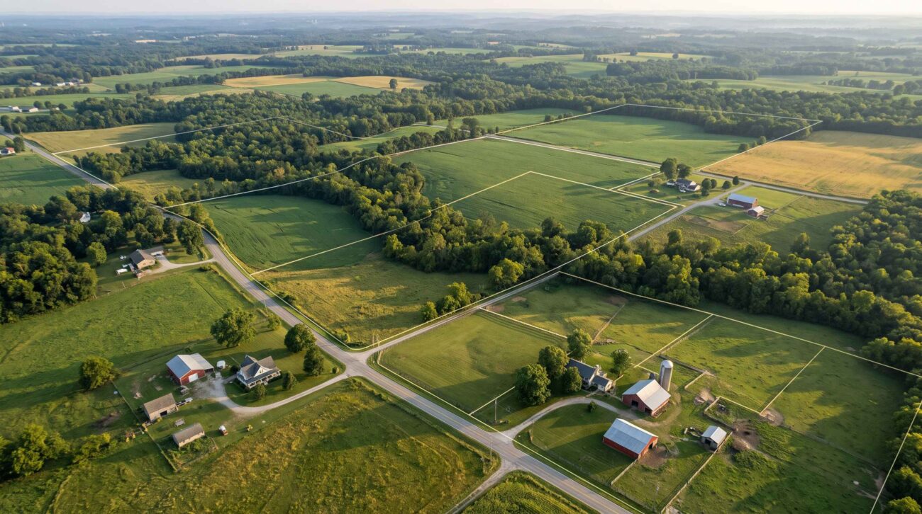
A rural land listing can promise privacy, mountain views, and enough acreage for a cabin. But owning the land does not automatically mean you can build the home you want, park an RV indefinitely, operate a business, or divide the property into smaller lots.
Before purchasing rural land in the United States, buyers need to understand the rules that apply to the specific parcel.
Zoning is one of the most important parts of that investigation. It determines which land uses are allowed in many communities, but it is only one part of the approval process. Building codes, environmental restrictions, deed restrictions, access rights, and utility requirements can create additional limitations.
This guide explains how to find a property’s zoning designation, interpret local regulations, ask the right questions, and document your findings before closing.
1. Understand What Zoning Actually Controls
Zoning is a land-use regulatory system commonly administered by cities, towns, townships, or counties.
A zoning ordinance may regulate:
- Residential, agricultural, commercial, and recreational uses
- Minimum lot size and lot width
- Building height and placement
- Setbacks from roads and property boundaries
- Number and type of structures
- Manufactured and mobile homes
- Accessory dwelling units and guest cabins
- RV occupancy and camping
- Home-based businesses and short-term rentals
- Subdivision of land
However, zoning systems vary substantially across the country.
Some rural areas have detailed zoning ordinances. Others have limited zoning or no conventional zoning ordinance, while still enforcing subdivision, building, sanitation, environmental, or other land-use rules.
Important distinction: A property described as “unrestricted” in a listing is not proof that every intended use is legal.
2. Step One: Identify the Exact Parcel
Before searching zoning maps, collect the property’s identifying information.
Request the parcel identification number, street address if assigned, county, state, legal description, and any available survey.
A parcel number is particularly useful when vacant land has no conventional street address.
Be careful with online listing boundaries. Some real estate websites display approximate parcel outlines, which may not reflect a professional survey or recorded legal boundaries.
If the property consists of multiple tax parcels, investigate each parcel separately. Adjacent parcels may have different zoning designations, legal access arrangements, or development limitations.
Documents to request
| Document | Why it matters |
|---|---|
| Parcel identification number | Helps identify the property in county records |
| Legal description | Defines the property in recorded documents |
| Current survey | Helps identify boundaries and potential building areas |
| Deed | May reveal recorded restrictions or references to other documents |
| Title commitment or report | Can identify recorded easements and exceptions |
| Seller disclosures | May identify known land-use or permit issues |
A tax parcel map is useful for research, but it is not automatically a boundary survey.
3. Step Two: Find the Local Zoning Authority
There is no single national zoning database that can reliably confirm what you may build on every U.S. parcel.
Start with the local government that has land-use authority over the property.
Search for the county or municipality’s official planning, zoning, or community development department.
For example, use a search such as:
“[County name] [State] zoning map official”
Or:
“[Township name] zoning ordinance PDF”
Look for official government websites, typically operated by the relevant county, city, township, or planning department.
Do not assume the county is always the correct authority. An incorporated town may administer its own zoning, while an unincorporated area may fall under county or township rules.
Ask the planning office:
Which government has zoning jurisdiction over parcel [parcel number], and where can I obtain its current zoning map and ordinance?
If the office says the area has no zoning ordinance, ask which other land-use and development regulations still apply.
4. Step Three: Find the Zoning Designation
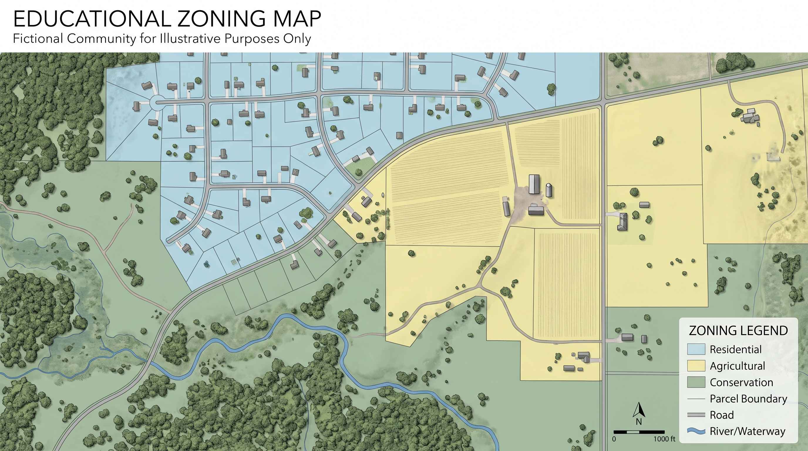
Once you have located the official zoning map, search for the parcel using its identification number, address, or geographic location.
You may encounter labels such as:
| Example zoning label | Possible general purpose |
|---|---|
| Agricultural (A or AG) | Farming and certain related uses |
| Rural Residential (RR) | Low-density residential development |
| Residential (R) | Housing, subject to district-specific standards |
| Forestry or Resource (F) | Forestry and natural-resource-related uses |
| Conservation (C) | Protection of environmental or open-space resources |
| Commercial (C or B) | Business-related activities |
These abbreviations are illustrative only. The same letters can mean different things in different jurisdictions.
A parcel labeled Agricultural does not automatically permit every farming activity, campground, or residential structure.
Record the full district name and code, not just the abbreviation.
Also check for overlay districts, special planning areas, or other regulations that apply in addition to the underlying zoning designation.
5. Step Four: Read the Actual Zoning Ordinance
Finding the district on a map is only the beginning.
The zoning ordinance explains what that designation means.
Look for the following sections:
Permitted uses: Activities allowed by the district rules, often subject to other permits and standards.
Conditional or special uses: Activities that may require a separate review, public hearing, or discretionary approval.
Prohibited uses: Activities not allowed under the applicable regulations.
Dimensional standards: Requirements for lot size, frontage, building height, setbacks, and sometimes lot coverage.
Definitions: Local definitions of terms such as dwelling, recreational vehicle, manufactured home, accessory structure, or campground.
Nonconforming uses: Rules that may apply to existing structures or activities that do not meet current requirements.
Overlay districts: Additional restrictions for certain locations, such as flood-prone or environmentally sensitive areas.
A critical point is that a use may be generally allowed in a district but still require permits and compliance with other standards.
Example: “Single-family dwelling permitted”
That phrase alone does not confirm that a buyer can immediately build.
The parcel may still need to meet minimum frontage requirements, road-access rules, wastewater standards, setbacks, and building-permit requirements.
6. Step Five: Check Whether You Can Build a House or Cabin
If your goal is to construct a residence, ask the planning and building departments about the specific project.
Important questions include:
- Is a single-family dwelling allowed on this parcel?
- Is the parcel recognized as a legal building lot?
- Does it meet minimum acreage, lot width, and road-frontage requirements?
- Are there minimum dwelling-size rules?
- Are cabins, tiny homes, or manufactured homes treated differently?
- What are the front, side, and rear setbacks?
- Are there restrictions on the number of dwellings?
- Are separate guest cabins or accessory dwelling units allowed?
- Does the parcel require a zoning clearance before a building permit?
- Are any special approvals or variances necessary?
A large parcel is not automatically buildable.
For example, a 20-acre property may have enough total area but lack suitable legal road frontage, an approved wastewater site, or a compliant building location.
For a more detailed construction feasibility guide, read Can You Build a House on Cheap Rural Land? 9 Things to Check First.
7. Step Six: Investigate RVs, Tiny Homes, and Mobile Homes
Many buyers are attracted to inexpensive rural land because they hope to live in an RV, install a tiny home, or place a manufactured home on the property.
These options require careful investigation.
Recreational Vehicles
Ask whether the local ordinance allows:
- Temporary recreational camping
- Seasonal RV occupancy
- Full-time RV residence
- RV parking while a house is under construction
- Utility connections to an RV
- Multiple RVs or a private campground
Some jurisdictions permit limited recreational use but restrict permanent habitation.
Tiny Homes
A tiny home on a permanent foundation may be regulated differently from a tiny home on wheels.
The applicable building code, minimum dwelling requirements, zoning definitions, and utility rules may all matter.
Manufactured Homes
Manufactured housing may be allowed in some districts, subject to installation standards and other applicable requirements.
Do not assume that a listing described as “mobile-home friendly” establishes approval for a specific model or installation.
Buyer rule: Describe the exact type of structure and intended occupancy to the planning office. Avoid relying on vague terms such as “small cabin.”
8. Step Seven: Check Farming, Animals, and Business Uses
Rural acreage can be attractive for homesteading, livestock, workshops, and home businesses.
However, agricultural zoning does not necessarily authorize every activity associated with rural living.
Depending on local rules, buyers may need to verify:
- Whether livestock are permitted and whether animal-number limits apply
- Minimum acreage or setbacks for animal shelters
- Rules for commercial farming or farm-related sales
- Whether a workshop or repair business is allowed
- Restrictions on outdoor storage
- Home-business permits and customer traffic limits
- Short-term rental and vacation cabin regulations
- Campground or glamping permits
For example, keeping a few chickens for personal use and operating a commercial poultry business may be regulated differently.
Likewise, a personal workshop may be allowed while a business involving frequent customers, noise, or commercial vehicles may require separate approval.
9. Step Eight: Investigate Setbacks and the Actual Buildable Area
A parcel’s total acreage can be misleading.
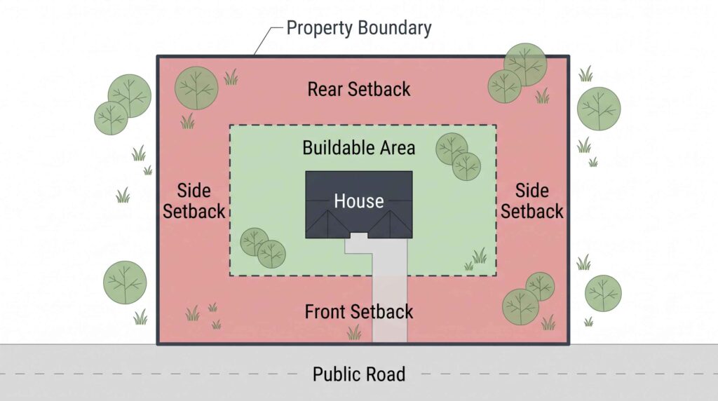
A 10-acre property may contain steep slopes, wetlands, utility easements, drainage areas, or required setbacks that significantly reduce the area available for construction.
Consider this hypothetical example:
A buyer finds a 10-acre wooded parcel. The zoning district permits residential development, but the proposed building location must also account for road setbacks, property-line setbacks, a utility easement, and a suitable septic area.
The buyer may need to redesign the site plan or move the house to a different part of the property.
What to verify
Ask the local planning department for applicable setbacks and any required minimum lot dimensions.
Review recorded easements with a title professional or attorney.
Ask the health department about wastewater setbacks and site evaluation requirements.
Use the USDA Web Soil Survey to investigate general soil characteristics and potential land-use limitations. USDA soil data is useful for early screening but does not replace site-specific evaluations or permit decisions.
If wetlands may be present, ask the appropriate state or federal agency whether additional review is needed. Certain discharges of dredged or fill material into regulated waters, including wetlands, require authorization under Clean Water Act Section 404 unless an exemption applies.
The goal is to identify a realistic building area—not merely confirm that the zoning district lists residential use as permitted.
10. Step Nine: Check Road Access and Other Restrictions
Even if zoning permits a residence, the property may still have access problems.
A road visible on satellite imagery does not necessarily establish a legal right to use it.
Buyers should verify:
- Recorded legal access
- Public-road frontage or a valid access easement
- Road maintenance responsibility
- Driveway or road-entrance permit requirements
- Emergency vehicle access standards
- Restrictions on building or improving private roads
Read our detailed guide: How to Check Legal Road Access Before Buying Rural Land in the USA.
Zoning Is Not the Only Restriction
A parcel may also be affected by:
Deed restrictions: Recorded private limitations that may restrict buildings or land use.
HOA or association rules: Rules that may apply even when local zoning allows an activity.
Conservation easements: Recorded agreements that may limit development or certain land uses.
Floodplain rules: Building requirements or limitations that may apply in mapped flood-hazard areas.
Environmental permits: Requirements involving wetlands, waterways, protected resources, or land disturbance.
Utility and sanitation rules: Requirements for wells, septic systems, and other infrastructure.
These restrictions should be investigated independently.
11. Step Ten: Obtain Written Confirmation Before Closing
A phone conversation with a zoning official can help identify issues, but buyers should not rely solely on informal verbal explanations for an important purchase decision.
Ask whether the jurisdiction provides a written zoning verification letter, zoning determination, land-use inquiry response, or similar document.
The name and legal effect of these documents vary.
Provide the office with:
- Parcel number and address
- Proposed use
- Type and approximate size of structure
- Whether the property will be occupied year-round
- Plans for RVs, additional cabins, livestock, or commercial activity
- Any intended subdivision
A useful request might read:
I am considering purchasing parcel [parcel number] in [county and state]. I would like to construct one year-round single-family residence and install an approved well and wastewater system. Please confirm the current zoning district, whether the proposed residential use is allowed, applicable dimensional standards, and any additional land-use approvals required.
A written response may clarify the rules, but it is not necessarily a building permit, development approval, or guarantee that all other agencies will approve the project.
Where material uncertainty remains, discuss appropriate due-diligence or approval contingencies with a qualified local real estate attorney before committing to the purchase.
12. Three Rural Zoning Scenarios Buyers Should Understand
The following are fictional examples intended to illustrate different due-diligence problems.
| Scenario | What the listing says | What must be verified |
|---|---|---|
| Property A | “5 acres, perfect for a tiny home” | Whether the proposed tiny-home design qualifies as an allowed dwelling |
| Property B | “40 unrestricted acres” | Whether zoning exists, what other development rules apply, and whether deed restrictions exist |
| Property C | “Beautiful land for RV living” | Whether full-time RV occupancy is permitted and what sanitation requirements apply |
Property A: The Tiny Home Problem
The land may be zoned residential, but that does not necessarily mean every tiny-home configuration is permitted.
A buyer needs to identify whether the planned home is on a foundation or wheels and ask which codes and land-use definitions apply.
Property B: The “Unrestricted” Claim
Even where conventional zoning is absent, a buyer may still need building permits, wastewater approval, driveway permits, and compliance with recorded restrictions.
The word “unrestricted” should trigger additional questions, not end the investigation.
Property C: Recreational Versus Permanent Use
A jurisdiction may allow short-term camping while restricting permanent RV residence.
Buyers should confirm the maximum duration of occupancy, required permits, and whether any exceptions apply.
13. Common Zoning Red Flags
Watch for these warning signs during the purchase process.
| Warning sign | Why it matters | Next action |
|---|---|---|
| “You can build anything” | May be an unsupported seller claim | Ask the planning office for the applicable rules |
| No clear parcel number | Makes accurate research difficult | Obtain county parcel records |
| Conflicting zoning maps | May indicate outdated or overlapping information | Request an official determination |
| Existing unpermitted structure | Could create compliance problems | Review permit and enforcement records |
| Property recently subdivided | New lots may not meet development standards | Verify legal-lot status |
| “RV living allowed” without documentation | Occupancy rules may be restrictive | Ask about permanent versus temporary use |
| Wetlands cover the preferred building area | Environmental approvals may be required | Request qualified site assessment |
| Seller promises a variance | Approval may be discretionary | Do not assume approval will be granted |
What About a Zoning Variance?
A variance is a form of relief from certain zoning requirements, where authorized by local law.
The standards and approval process differ by jurisdiction. A variance may involve findings, notice, hearings, or conditions.
It should not be treated as an automatic way to make an otherwise unsuitable parcel buildable.
Similarly, rezoning a parcel or obtaining a conditional-use approval can require a separate process with an uncertain outcome.
14. Rural Land Zoning Due-Diligence Checklist
Use this checklist before purchasing.
Parcel Identification
- Obtain the parcel identification number.
- Confirm county and municipal jurisdiction.
- Review the legal description and available survey.
- Check whether the purchase includes multiple parcels.
Zoning and Permitted Uses
- Locate the official zoning map.
- Record the current zoning district.
- Read the relevant ordinance and definitions.
- Check overlay districts and special restrictions.
- Confirm the exact intended use is permitted.
- Identify any conditional-use or special-approval requirements.
Construction Feasibility
- Confirm legal building-lot status.
- Verify minimum lot size and frontage.
- Check building setbacks and height limits.
- Ask about the proposed dwelling type.
- Investigate well and wastewater requirements.
- Identify an appropriate potential building location.
Other Restrictions
- Review recorded easements and deed restrictions.
- Verify legal road access.
- Check HOA or association rules if applicable.
- Investigate wetlands, floodplain, and environmental limitations.
- Check for known code violations or permit problems.
Before Closing
- Submit a written land-use inquiry to the appropriate authority.
- Keep copies of maps, ordinances, emails, and determinations.
- Obtain professional advice where necessary.
- Resolve major uncertainties before the relevant contract deadlines.
Frequently Asked Questions
How do I find the zoning of rural land?
Start with the parcel identification number, then consult the official zoning map and ordinance maintained by the relevant county, city, or township. Contact the planning office if the map is unclear or conflicting.
Does agricultural zoning allow me to build a house?
Sometimes, but not automatically. Residential uses and development standards vary by jurisdiction. Ask whether your proposed dwelling is allowed and whether the parcel meets the applicable requirements.
Can I live in an RV on my own land?
That depends on local land-use, occupancy, sanitation, and related rules. Ownership alone does not establish a right to use an RV as a permanent residence.
What does unrestricted land mean?
It is often a marketing description rather than a legally precise classification. The property may still be subject to building, subdivision, sanitation, environmental, or private restrictions.
Can I build a cabin without a permit?
Some jurisdictions have exemptions for particular structures or activities, but requirements vary. A small or recreational cabin is not automatically exempt from zoning, building, or wastewater rules.
Can zoning change after I buy land?
Yes. Local governments may amend zoning ordinances or maps through applicable legal procedures. Existing lawful uses may receive certain protections, but those rules vary. Ask about pending proposals and how future changes could affect the property.
Is a zoning map enough to confirm buildability?
No. Zoning is only one part of development feasibility. Legal access, wastewater approval, physical site conditions, building codes, and recorded restrictions may also matter.
Final Thoughts
The safest way to investigate rural land is to begin with the exact parcel and the buyer’s intended use.
Find the responsible planning authority, confirm the zoning district, read the ordinance, and ask specific questions about the proposed home, cabin, RV, or business.
Then investigate the other factors that can determine whether the land is usable: road access, sanitation, utilities, environmental restrictions, and private deed limitations.
A low purchase price is only attractive when the property can legally and practically support the buyer’s plans.
Before closing, seek written answers to the questions that matter most.
Official Research and Verification Resources
USDA Natural Resources Conservation Service — Web Soil Survey
https://www.nrcs.usda.gov/resources/data-and-reports/web-soil-survey
Use this tool to research soil characteristics and general land-use limitations. It does not replace site-specific assessments or regulatory approvals.
U.S. Environmental Protection Agency — Clean Water Act Section 404 Permit Program
https://www.epa.gov/cwa-404/permit-program-under-cwa-section-404
Explains the federal permit framework for certain activities involving regulated waters and wetlands.
U.S. Environmental Protection Agency — Septic Systems
https://www.epa.gov/septic
Provides information about onsite wastewater systems, maintenance, and related issues.
FEMA — Flood Map Service Center
https://msc.fema.gov/
Official flood-hazard mapping resource. If the service is temporarily inaccessible, consult the local floodplain administrator or relevant state floodplain office.
Local County, City, or Township Planning Department
The controlling zoning map, ordinance, and parcel-specific interpretation must be obtained from the appropriate local authority. There is no universal zoning determination applicable to all U.S. properties.
Disclaimer: This article is for general educational purposes only and does not constitute legal, engineering, land-use planning, or real estate advice. Zoning and permitting requirements vary by jurisdiction and may change. Buyers should verify parcel-specific rules with the responsible authorities and qualified local professionals before purchasing or developing land.
